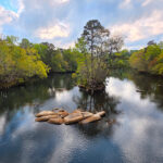
Columbia South Carolina offers many waterfront opportunities, but not many waterfront homesites to build on the water. The Reserve on the Saluda has 2 gorgeous, spacious lots available, but they will take a unique buyer's interest. When you see them, you'll want to snap one up, we promise you, because to build on the water in the serene, wooded area where we are located is the IDEAL situation.
Right near the South Carolina State House in the middle of beautiful downtown Columbia (aka Cola aka Soda City aka Capital City of SC), you can dawn your waders and go fly fishing for trout, bravely paddle Class IV whitewater, serenely float down a lazy river and zip line from the trees over that water. What other capital city has as much to offer as Columbia? And the three rivers run through it!
See also About The Reserve On The Saluda
See also Life On The River Saluda
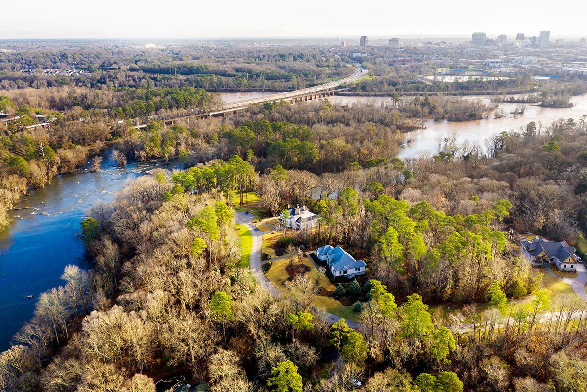
The Congaree, Broad and Saluda Rivers
As is often the case, Columbia’s history is tied inextricably to its landscape, and more specifically, its rivers. Serving as the highway of the day, South Carolina’s rivers provided ready access to an inland wilderness. Lowcountry Rivers led inland to the fall line, the area where the piedmont meets the coastal plain; an area that is characterized by the rapids and shoals of the Congaree, Broad and Saluda. It is a landscape of rivers, flood plain swamps and hardwood bluffs. These rivers tell a history of our state and our capital, Columbia.
Rivers would serve as the most important means of transportation in the state for the next 50 years. As river traffic increased, and Columbia began to grow, it became necessary to build a canal. It would be completed by 1824. The canal was excavated below the falls on the Broad River, just north of the city. It had an eight foot-wide towpath on each side. The state sponsored Columbia Canal was a notable example of engineering expertise in the nineteenth century. Robert Mills, a federal architect, was instrumental in its development. It would play a significant role in Columbia’s commercial and industrial growth.
The Congaree River was navigable for steamboats from Columbia to the Santee River. The waterway of more than 175 miles in length eventually drained into the Atlantic Ocean. Steamboats, tugs and canal boats regularly made the trip from Columbia to Charleston, via the Santee Canal, with more than 30,000 bales of cotton annually, and with full return freights. In 1822, the Carolina made the trip upriver in 4 ½ days.
In 1927, plans for the largest earthen dam in the world had been set in place, and by 1933, the landscape would change dramatically. Lake Murray inundated some 78 square miles of land as one of the largest man-made lakes in the world.
The Congaree, Broad, and Saluda Rivers provide miles of riverfront for South Carolina’s capitol city and played a significant role in Columbia’s landscape history. The story of our history is tied to the land, and as with many places, a river runs through it.
The Reserve on the Saluda is an exclusive, gated community like no other. Elegant, small, and secluded protected and surrounded by mature hardwoods draped in Spanish moss right on the majestic Saluda River.
ONLY TWO PREMIER, RIVERFRONT HOMESITES REMAIN. TIME TO BUILD YOUR CUSTOM HOME!